Call or Text Number

Lake Powell Map
Lake Powell winds for well over 100 miles through Arizona and Utah, and most of it can only be reached by water. Use this map to see where everything is. Pick the marina you are starting from, then tap any canyon, beach or landmark to see how far it is by water, how long the ride takes, about how much fuel the round trip uses and the route along the main channel.
Pick a marina and book your rideBooking online is the fastest way to check availability, see live prices and reserve your rental.
The Four Marinas We Rent From
We rent jet skis and boats at all four main marinas on Lake Powell and launch from whichever ramp the lake level allows. Choose the one closest to where you want to go.
- Wahweap, about 7 miles from Page, Arizona. Closest to Lone Rock Beach, Glen Canyon Dam and the big bays to the north.
- Antelope Point, about 15 minutes east of Page. The shortest ride to Antelope Canyon, Navajo Canyon, Padre Bay and the southern canyons.
- Bullfrog, on the Utah side of the lake. The best start for the Escalante arm, Hole-in-the-Rock and the north lake.
- Halls Crossing, across the lake from Bullfrog in Utah. Close to Defiance House and the quiet upper lake.
Ride Distances from Each Marina
One-way miles by water along the main channel. At a relaxed 25 mph, 10 miles takes about 25 minutes and 50 miles about 2 hours, before wakeless zones and stops.
| Destination | Antelope Point | Wahweap | Bullfrog | Halls Crossing |
|---|---|---|---|---|
| Antelope Canyon | 2 | 5 | 95 | 94 |
| Glen Canyon Dam | 5 | 4 | 98 | 97 |
| Navajo Canyon | 5 | 11 | 91 | 90 |
| Lone Rock Beach | 10 | 4 | 102 | 102 |
| Warm Creek Bay | 11 | 17 | 91 | 90 |
| Padre Bay | 13 | 20 | 83 | 83 |
| Labyrinth Canyon | 14 | 20 | 81 | 80 |
| Face Canyon | 17 | 23 | 79 | 78 |
| West Canyon | 22 | 28 | 77 | 76 |
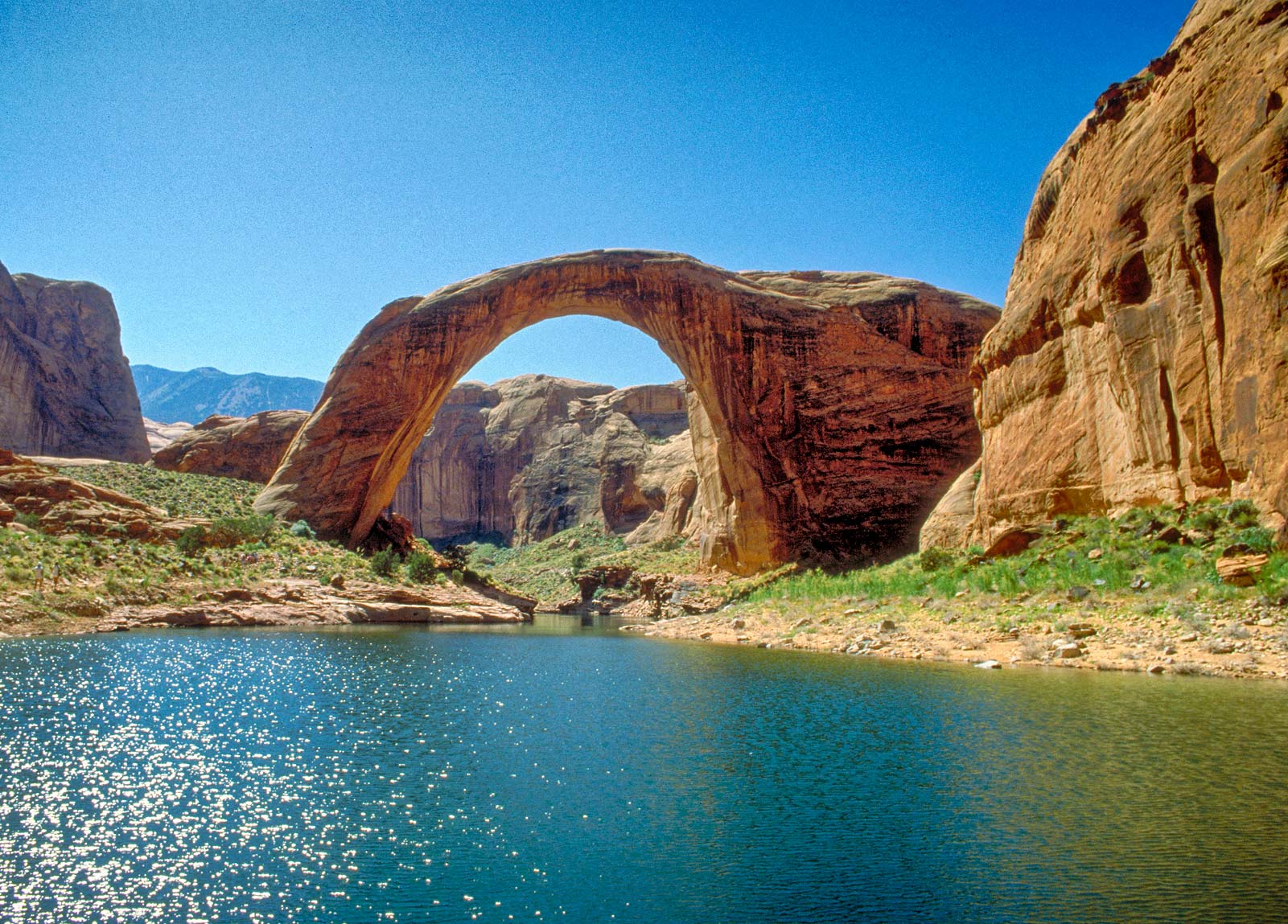
| Rainbow Bridge | 47 | 53 | 52 | 52 |
| Reflection Canyon | 52 | 58 | 42 | 41 |
| San Juan arm | 57 | 64 | 41 | 40 |
| Hole-in-the-Rock | 61 | 67 | 33 | 32 |
| Escalante arm | 64 | 70 | 29 | 29 |
| Cathedral in the Desert | 69 | 75 | 34 | 33 |
| Defiance House | 101 | 107 | 13 | 10 |
How Lake Powell Mile Markers Work
Lake Powell’s main channel is marked with numbered buoys, and the number is the distance in miles up the lake from Glen Canyon Dam. Antelope Canyon is near the bottom of the lake at about mile 2, Rainbow Bridge is around mile 49 and Bullfrog sits near mile 95. Green and red buoys mark the edges of the channel, so stay between them on long rides. When the lake drops, buoys are moved to follow the deep water, so always trust the buoy in front of you over a phone or a printed map.
Fuel, Wakeless Zones and Low Water
- Fuel: there is no fuel stop in the middle of the lake. Dangling Rope Marina, the old halfway fuel dock, is closed, so plan long rides as a round trip on one tank and keep a reserve.
- Wakeless canyons: Antelope Canyon and Labyrinth Canyon are wakeless at all times. Slow to wakeless speed in any narrow canyon, near marinas and launch ramps, and around swimmers, kayaks and paddleboards.
- Castle Rock Cut: when the lake is high, the cut near Wahweap saves several miles on the way uplake. When it is closed, rides from Wahweap go around Antelope Island, as the map shows.
- Low water: the lake level changes which ramps are open, how far you can ride into each canyon and where you can land. Check Lake Powell water levels before a long trip.
- Weather: afternoon wind builds chop in the main channel and big bays. Ride early, and head for shore when storms build.
Best Rides by Time
- Two hours: Antelope Canyon and Navajo Canyon from Antelope Point, or Lone Rock Beach and the dam from Wahweap.
- Half day: Padre Bay, Gunsight Butte and Labyrinth Canyon, with time for a beach stop. See Lake Powell jet ski routes.
- Full day: Rainbow Bridge from Antelope Point or Wahweap, or the Escalante arm and Cathedral in the Desert from Bullfrog or Halls Crossing.
Places Off the Water
A few of the area’s most famous sights are on land near Page. Switch the map to On land to see them.
- Horseshoe Bend
- Upper vs. Lower Antelope Canyon
- Lees Ferry and Navajo Bridge
- Alstrom Point
- Things to do in Page, Arizona
Map Notes
Distances are approximate and measured along the main channel, so your real ride can be shorter or longer depending on the lake level and the line you take. The background maps are from the U.S. Geological Survey’s National Map. Use this map for planning, not navigation.
Ready to explore Lake Powell?Booking online is the fastest way to check availability, see live prices and reserve your rental.
Ready to ride Lake Powell?Booking online is the fastest way to check availability and see live prices.
Sea-Doo jet ski and MasterCraft boat rentals, water toys and guided tours on Lake Powell, ready at the marinas in Arizona and Utah.
- Open daily, 7am to 10pm
- Rentals at Wahweap, Antelope Point, Bullfrog and Halls Crossing
- 888-352-4298Text Us
Rentals
Destinations
© 2026 Lake Powell Rentals. All rights reserved.